Hiking trails.
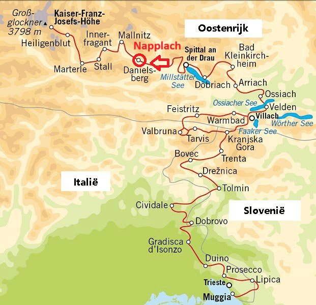
The Alpe Adria Trail is a fully marked, diverse hiking route with 43 stages through 3 Alpine countries: Austria, Italy, and Slovenia. This 750 km long route starts from the Großglockner, the highest mountain in Austria, passing through the Julian Alps in Slovenia and leading to the Adriatic Sea in Italy.
The stages vary in duration from 5 to 8 hours, with an average daily distance of about 17 km. The free Alpe Adria Trail app is a great tool for planning the hike both on the go and at home. The trail follows water in all its forms, from the eternal ice of the Großglockner glacier to waterfalls, rivers, and lakes, all the way to the sea. If you wish to hike the entire route, it will take about a month. For those not wanting to complete the whole trail, there are options to choose individual stages or a shorter version: the 3-country circular route.
Highlights of the Alpe Adria Trail.
Großglockner, the highest mountain in Austria.
The many mountains and lakes in Carinthia.
Kranjska Gora, known for the World Cup skiing.
The pristine Soča Valley in Slovenia.
Kobarid, cultural heritage from World War I.
Tolmin, a famous fishing spot known for its many marble trout.
Cividale del Friuli, UNESCO World Heritage site.